About Hazards and Population Mapper
Hazards and Population Mapper (HazPop) is a free app that enables users to easily display recent natural hazard data in relationship to population, major infrastructure, and satellite imagery. Hazards data include the...
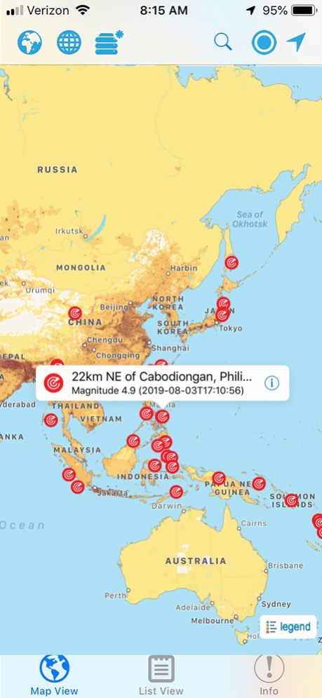
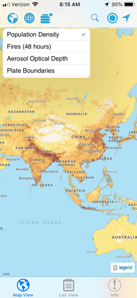
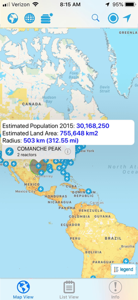
Hazards and Population Mapper (HazPop) is a free app that enables users to easily display recent natural hazard data in relationship to population, major infrastructure, and satellite imagery. Hazards data include the location of active fires over the past 48 hours; earthquake alerts over the past seven days; and yesterday′s air pollution data measured from space. The app shows the location of major dams and nuclear power plants and provides more detailed information and imagery for these facilities where available. By drawing a circle around a point or area of interest on the map, users can obtain an estimate of the total population and land area enclosed within.
Developed by the NASA Socioeconomic Data and Applications Center (SEDAC) operated by the Center for International Earth Science Information Network (CIESIN) at Columbia University, HazPop combines data and map layers from various sources including NASA's Land, Atmosphere Near real-time Capability for EOS (LANCE) and Global Imagery Browse Services (GIBS), the U.S. Geological Survey (USGS), and others using a variety of open Web mapping services. The custom population estimates are provided by the SEDAC Population Estimation Service (PES) based on SEDAC′s Gridded Population of the World, version 4 (GPWv4) data for 2015.
HazPop is designed to be used by disaster risk managers, humanitarian response organizations, public health professionals, journalists, and others needing a quick assessment of the potential dangers posed by a major hazardous event or developing emergency. For example, a disaster response agency can obtain a rough estimate of the population and major facilities near a recent earthquake as an input into response planning. Journalists or students can explore the location of recent wildfires relative to dense populations, roads, terrain, and water bodies. Due to the coarse resolution and varying quality of some of the data, HazPop is not intended to support in-depth risk assessment or location-specific response needs.
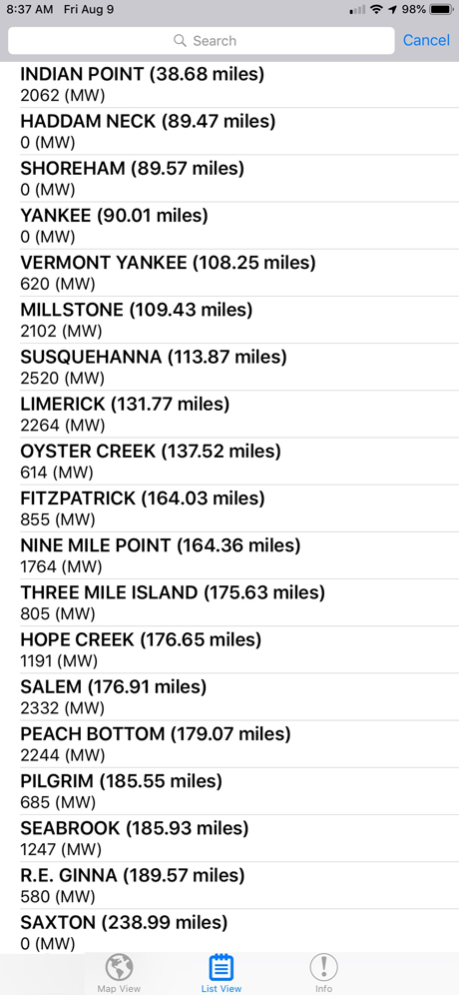
HazPop supports a number of other functions including: Monitoring regions around an area of interest, e.g. hazardous area prone to natural disasters, major infrastructure, or densely populated areas; Sorting dams, nuclear power plants, or earthquakes by proximity to your location or by their characteristics; Determining the distance from your location to any point on the map or between any two points on the map.
Aug 10, 2019
Version 2.0
* The population estimation is now based on the new version 3.0 of the SEDAC Population Estimation Service (PES v3), which uses the latest version 4.11 of the SEDAC Population Count data set from the Gridded Population of the World (GPW) data collection.
* Added ability to display chart showing estimated population trend changes in 5-year intervals from 2000 to 2020.
* New imagery layer from NASA GIBS for display of global fires in the last 48 hours.
Previous Versions
Here you can find the changelog of Hazards and Population Mapper since it was posted on our website on 2023-09-04 16:23:29.
The latest version is 2.0 and it was updated on 2024-04-22 09:24:34. See below the changes in each version.
Hazards and Population Mapper version 2.0
Updated At: 2019-08-10
Changes: Aug 10, 2019
Version 2.0
* The population estimation is now based on the new version 3.0 of the SEDAC Population Estimation Service (PES v3), which uses the latest version 4.11 of the SEDAC Population Count data set from the Gridded Population of the World (GPW) data collection.
* Added ability to display chart showing estimated population trend changes in 5-year intervals from 2000 to 2020.
* New imagery layer from NASA GIBS for display of global fires in the last 48 hours.
Disclaimer
Official App Store Link
We do not host Hazards and Population Mapper on our servers. We did not scan it for viruses, adware, spyware or other type of malware. This app is hosted by Apple and passed their terms and conditions to be listed there. We recommend caution when installing it.
The App Store link for Hazards and Population Mapper is provided to you by apps112.com without any warranties, representations or guarantees of any kind, so access it at your own risk.
If you have questions regarding this particular app contact the publisher directly. For questions about the functionalities of apps112.com contact us.